Skip to content


How LiDAR Drones And The DJI Zenmuse L3 Solve City Flooding
- by Stefan Gandhi
A flood-hit town in the Philippines has shown how LiDAR drones can turn a stubborn drainage problem into a solvable engineering task. Using the DJI Zenmuse L3 LiDAR payload, a survey team mapped 470 hectares of Mariveles in Bataan in just two hours and delivered the terrain data the local government needed to plan its flood defences. This article looks at the flood challenge, how the LiDAR survey worked, and why the numbers are so striking against traditional methods.
The Flooding Problem In Mariveles
Mariveles, a coastal municipality in Bataan, has suffered recurring flash floods for years. During the rainy season from July onwards, water rushes down from the surrounding mountains and overwhelms drainage channels that are too narrow, too shallow, and often clogged with waste. Depending on the area, flooding ranges from knee-deep to dangerously high, putting residents at real risk.
The local government had already planned major drainage and flood control projects. The problem was not intent, it was information. Officials lacked accurate terrain data showing where water collects and how it flows, which meant they could not confidently decide where to begin or which infrastructure to prioritise. Without that foundation, a drainage master plan is guesswork.
Why LiDAR Drones Suit Flood Mapping
Flood modelling lives and dies on the quality of the elevation data behind it. LiDAR, which stands for light detection and ranging, fires laser pulses at the ground and measures the return, building a dense three-dimensional point cloud of the surface. The key advantage over a standard camera survey is that LiDAR can distinguish the true ground from vegetation and structures, letting engineers strip away the canopy and model the bare terrain that water actually runs across.
That bare-earth model, known as a digital terrain model, is exactly what flood planning needs. It reveals the low points where water pools, the natural channels it follows downhill, and the exact coordinates where new drainage would do the most good. For a town like Mariveles, hemmed in by mountains and sea, that level of detail is the difference between a hopeful plan and a targeted one.
Inside The Zenmuse L3 Survey
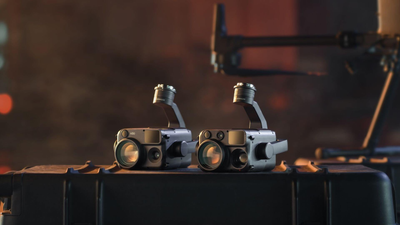
Techdynamics, the master distributor of DJI Enterprise in the Philippines, partnered with the Mariveles local government and deployed the DJI Zenmuse L3 to map the town. The team divided the area into three zones and covered the full 470 hectares in around two hours of flying. Post-processing the captured point cloud data took roughly six hours, producing the 3D terrain models, orthomosaic maps, and classified point clouds the engineers needed.
From that data the team could generate hazard maps that clearly show which areas are most dangerous during a flood. Those outputs feed disaster simulations, letting planners visualise how rainfall moves across the landscape and where it accumulates. In the words of the local disaster officer, the mapping shows the hazard areas that are genuinely the most dangerous, which is precisely the insight emergency planning depends on.
The Numbers That Make The Case
The efficiency gain is the headline. Traditionally, surveying a 470-hectare area with RTK equipment and a total station would tie up two or three teams for three to four months. The Zenmuse L3 survey captured the same ground in two hours of flight and six hours of processing. That is a change measured in months versus a single working day.
For a local government working to a budget and a monsoon calendar, that speed is transformative. It means terrain data can be refreshed as conditions change, and it removes the long delay that used to sit between deciding to act and having the data to act on. The mayor summed up the ambition simply, expecting that within ten years the town will have meaningfully reduced its flooding.
What This Means For Surveyors And Planners
The Mariveles project is a clear template for any authority facing flood risk, land management, or large-scale infrastructure planning. A single LiDAR-equipped drone crew can now deliver survey-grade terrain data at a scale and speed that once required large field teams and months of work. That lowers the barrier to evidence-based planning, and it puts accurate mapping within reach of smaller municipalities that could never fund a traditional survey of the same size.
The wider lesson is that LiDAR drones are no longer a specialist novelty. They are becoming the practical, cost-effective way to capture the ground truth behind serious decisions, from flood defence to construction and environmental management.
FAQs
What is a LiDAR drone used for?
A LiDAR drone is used to capture highly accurate 3D terrain data for surveying, mapping, flood modelling, construction, forestry, and infrastructure planning. Because LiDAR can see through vegetation to the ground beneath, it is especially useful where a bare-earth elevation model is needed.
How does LiDAR help with flood mapping?
LiDAR builds a precise digital terrain model that shows exactly where land is high and low. Planners use that model to predict where water will collect and flow, identify the most flood-prone areas, and pinpoint where new drainage will be most effective.
What is the difference between LiDAR and photogrammetry?
Photogrammetry builds a model from overlapping photographs and captures the surface as seen from above, including vegetation. LiDAR fires laser pulses and can separate ground returns from vegetation and structures, so it produces a more reliable bare-earth model, particularly in vegetated terrain.
How fast can a LiDAR drone survey a large area?
Very fast compared with ground survey. In the Mariveles project, a DJI Zenmuse L3 mapped 470 hectares in about two hours of flying, with roughly six hours of processing, against three to four months for a traditional survey of the same area.
Final Thoughts
The Mariveles project shows what LiDAR drones make possible, turning a recurring flood problem into a data-driven plan in a fraction of the time and cost of traditional surveying. With the DJI Zenmuse L3 delivering survey-grade terrain data in hours rather than months, authorities and surveyors have a genuinely practical tool for tackling flood risk and large-scale mapping.
Explore the DJI Zenmuse L3 and the wider enterprise range at the Coptrz official online store.