Skip to content


Inside The 17 Day Austrian Wildfire Response That Ran On Drones
- by Stefan Gandhi
A wildfire that broke out north of Graz on 25 April 2026 burned through roughly 70 hectares of steep Austrian forest and took 17 days to extinguish. Across that fortnight drones logged more than 300 flight hours, most of them after dark, hunting embers buried under the surface and passing coordinates straight to ground crews. The operators involved have since described how they worked, and their account is one of the clearest explanations available of what a thermal drone actually contributes to a long wildfire response.
What Happened At Eisbach Rein
The alert came around midday on 25 April 2026 for a forest fire at Rein, north of Graz in the Austrian state of Styria. The drone unit for the Graz Umgebung district was put on standby immediately.
By the time the fire was declared out on 11 May, around 2,350 emergency responders had been involved, supported by roughly 580 vehicles and 11 helicopters. Austrian broadcaster ORF reported the response cost approaching two million euros, and forest officials described it as the largest fire brigade operation in the history of Styria. Crews were lowered into steep terrain carrying backpack sprayers because vehicles could not reach the fire line. Police later concluded the fire started through negligence during forestry work.
Why The Drone Unit Flew After Dark
Helicopters had priority in the airspace during daylight hours, so the drone unit took over continuous aerial monitoring after nightfall. That constraint turned out to suit the task perfectly.
As the unit explained, night and the early morning hours deliver the best results, because that is when the temperature difference between the cooled forest floor and hidden embers is at its greatest. A thermal camera reads contrast, and a cold forest floor makes a buried hotspot stand out in a way that midday sun on dry ground never will. What began as an airspace deconfliction measure became the most productive window of the entire operation.
How Thermal Imaging Found Embers Before The Smoke
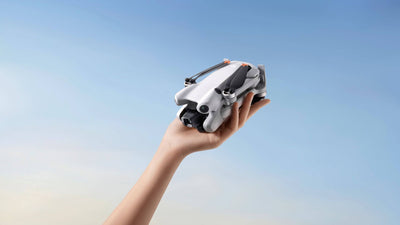
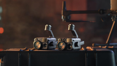
The unit flew a DJI drone with a high resolution thermal imaging camera, supplying incident command with regular updated situational images and giving targeted support to the crews working the ground.
The detection sequence is worth understanding, because it explains why this work matters so much. The camera picks up hotspots long before they become visible on the surface or produce any smoke at all. Coordinates go to the ground crews, and when those crews open up the affected area they find embers burning at several hundred degrees Celsius under material that looked completely inert from above.
That is the gap thermal drones close. Without the aerial picture, those embers stay hidden until they surface as fresh flame, usually overnight and usually somewhere a crew has already declared safe.
Checking The Same Coordinates Again And Again
Detection is only half the job. The unit flew over the same coordinates repeatedly to confirm that areas already extinguished genuinely remained non critical.
This is the unglamorous work that decides how long a wildfire lasts. Fire in this kind of forest travels into root systems and organic layers below the surface, where it smoulders out of reach of water dropped from the air. A hillside can look finished at dusk and be alight by morning. Repeat thermal sweeps of ground that has already been worked are the only reliable way to know the difference between out and quiet, and they are exactly the kind of persistent, repetitive task that a drone handles well and an exhausted crew on foot does not.
Depending on conditions, the unit reported covering up to five hectares per hour with the DJI drone. Across a 70 hectare fire that is a full site sweep in a shift, repeated night after night.
The Tactical Case For A Drone Unit
Asked what the main advantage is, the unit put it in two words. Immediate availability and enormous flexibility.
The crew is ready for take off within a very short time, can operate around the clock, and feeds incident command precise data in real time. That saves valuable time in the initial phase of an incident, conserves resources and lifts the efficiency of the whole firefighting operation. Compared with manned aircraft, the unit operates at close to no additional cost during an ongoing mission, which matters enormously on an incident that runs for more than two weeks.
The point they returned to, though, was risk. Forest fires in steep and difficult terrain are unpredictable and dangerous for ground crews, and the drone provides the information that keeps people out of ground they should not be standing on. In their own framing, the drone actively protects human lives.
What UK Fire And Rescue Teams Can Take From It
The UK does not have Austria's alpine terrain, but it does have wildfire with the same underlying behaviour. Moorland and heathland fires in the Peak District, on Saddleworth Moor and across parts of Scotland and Wales all involve deep burning fuel that reignites after the visible fire is out, and peat can smoulder for weeks.
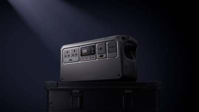
Three lessons carry across directly. Thermal drones earn their place in the days after the flames are gone rather than during the dramatic phase. Night flying should be planned for as the primary detection window rather than treated as an exception. And endurance beats peak specification on a long incident, because 300 flight hours over 17 days is a battery and crew rotation problem as much as an aviation one.
FAQs
How do drones help fight wildfires?
Drones give incident command a live overhead view of the fire front and crew positions, and thermal cameras let them locate smouldering hotspots that are invisible from the ground. Coordinates are passed to ground crews so hotspots can be dug out and extinguished precisely, which shortens the operation and keeps people out of unnecessary danger.
Can thermal drones detect underground fires?
Thermal cameras detect heat reaching at or very near the surface, which is enough to find smouldering root pockets and shallow burning material before any smoke appears. Crews opening up those locations regularly find embers burning at several hundred degrees Celsius.
Why do firefighters fly drones at night?
Ground temperatures drop after dark, which widens the contrast between a hidden ember and the cooled forest floor around it and makes thermal imagery far easier to read. Night and early morning are therefore the most productive windows for building a hotspot map.
How much ground can a drone cover on a wildfire?
The Austrian drone unit reported covering up to five hectares per hour depending on conditions. That figure varies with terrain, wind, flight altitude and how thoroughly an area needs to be swept.
What was the largest wildfire in Austria in 2026?
The fire near Eisbach Rein north of Graz, which started on 25 April 2026 and burned around 70 hectares over 17 days, became the largest fire brigade operation in the history of the Austrian state of Styria.
Final Thoughts
The headline number from Eisbach Rein is 17 days, but the number that matters operationally is 300 flight hours. That is what it takes to keep an accurate thermal picture of a burning hillside long after the flames have gone, and to keep crews from digging blind on ground that can reignite behind them. Sustaining that means an aircraft built for repeated operational use, a radiometric thermal sensor good enough to read faint contrast, and enough batteries to fly all night.
Building a wildfire capability for your team? Explore the DJI Matrice 4T thermal drone at the Coptrz official online store.