Skip to content


DJI Mavic 3 Enterprise Used to Study Glaciers In Greenland
- by Stefan Gandhi
Greenland is undergoing rapid environmental change, with glaciers retreating and icebergs calving at an accelerating rate. For scientists, understanding these processes in detail has become critical for predicting future climate scenarios. A recent case study from DJI Enterprise highlights how the DJI Mavic 3 Enterprise is enabling researchers to capture high-resolution aerial data in some of the most challenging environments on Earth. By combining mobility, precision and advanced imaging capabilities, drones are transforming how glacier dynamics are studied, offering insights that were previously difficult or impossible to obtain.
Understanding Greenland’s Changing Ice Landscape
Greenland sits at the centre of global climate discussions due to the scale and speed of change occurring across its ice sheet. Rising temperatures are accelerating ice loss, leading to more frequent and intense calving events where large sections of ice break away into the ocean.
Satellite imagery has played a major role in tracking these changes over time. It provides a valuable macro view, helping scientists monitor ice coverage and long-term trends. However, satellites lack the resolution required to analyse detailed processes such as crevasse formation, iceberg fragmentation and melt rates at a granular level.
This is where drone technology is making a significant impact. By capturing detailed aerial imagery close to the glacier surface, drones enable researchers to bridge the gap between large-scale observation and fine-detail analysis.
The Role Of The DJI Mavic 3 Enterprise In Glacier Research
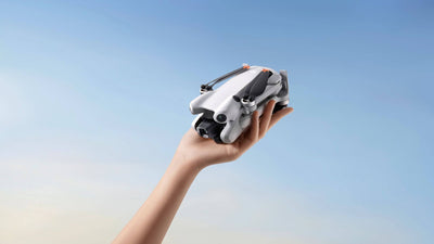
The DJI Mavic 3 Enterprise is designed for professional applications where reliability, portability and data accuracy are essential. In Greenland, these capabilities are being put to the test in extreme Arctic conditions.
Researchers are deploying the drone near active glaciers to capture hundreds of overlapping images. These images are then processed using photogrammetry techniques to generate highly detailed 3D models of glacier surfaces and surrounding icebergs.
This approach allows scientists to:
- Measure glacier movement with high precision
- Analyse crevasse patterns and structural weaknesses
- Track iceberg formation and disintegration
- Estimate melt rates and ice volume changes
The portability of the platform is particularly valuable. Field teams operating in remote locations can transport and deploy the drone quickly, reducing reliance on heavier, more complex equipment.
Capturing High Resolution Data In Extreme Conditions
Operating in Greenland presents unique challenges. Harsh weather, freezing temperatures and difficult terrain all impact traditional data collection methods. Drones provide a safer and more efficient alternative to ground-based surveys.
By flying above glaciers and icebergs, researchers can capture data without exposing themselves to unstable ice surfaces or hazardous conditions. This significantly reduces risk while improving the quality and frequency of data collection.
The ability to gather high-resolution imagery is crucial. Detailed datasets allow scientists to observe subtle changes in ice structure, which can indicate larger shifts in glacier behaviour. These insights are essential for improving predictive climate models.
In areas such as Eqip Sermia, a tidewater glacier located on Greenland’s west coast, drones have been used to map heavily crevassed ice near the glacier terminus. These crevasses often indicate where future calving events may occur, providing valuable clues about how glaciers evolve over time.
From Images To 3D Models
One of the most powerful applications of drone data in this case study is the creation of 3D models. By stitching together hundreds or even thousands of images, researchers can reconstruct detailed digital representations of glaciers and icebergs.
These models provide several advantages:
- Accurate measurements of ice volume and surface features
- Visualisation of structural changes over time
- Identification of weak points that may lead to calving
- Improved understanding of meltwater flow and its effects
The ability to analyse icebergs in situ is particularly important. By studying how icebergs melt and break apart in real time, scientists can better understand how freshwater enters the surrounding ocean. This has direct implications for ocean circulation and marine ecosystems.
Why Detail Matters In Climate Research
Climate models rely heavily on accurate data. While large-scale trends are important, the underlying processes driving those trends often occur at much smaller scales.
For example, understanding how crevasses form and propagate can reveal how and when glaciers are likely to calve. Similarly, measuring the rate at which icebergs melt helps researchers estimate how much freshwater is being introduced into the ocean system.
Drone-derived data fills these knowledge gaps. It allows scientists to observe processes as they happen, rather than relying solely on indirect measurements or assumptions.
By integrating drone data with satellite observations, researchers can build more comprehensive models that capture both large-scale patterns and fine-scale dynamics.
Improving Safety & Efficiency In Field Research
Traditional glacier research often involves physically accessing unstable and remote environments. This can be both dangerous and time-consuming.
Drones offer a safer alternative. They enable researchers to collect data from a distance, reducing the need for direct interaction with hazardous terrain. This not only improves safety but also allows for more frequent data collection, leading to better temporal resolution in datasets.
Efficiency is another key benefit. With rapid deployment and automated flight planning, drones can cover large areas in a relatively short time. This is particularly valuable in regions where weather windows are limited and conditions can change quickly.
Applications Beyond Greenland
While this case study focuses on Greenland, the implications extend far beyond a single location. The same drone-based methodologies can be applied to a wide range of environmental and industrial use cases.
These include:
- Monitoring glaciers in other polar and alpine regions
- Assessing coastal erosion and sea level rise
- Supporting disaster response in flood or landslide scenarios
- Conducting environmental impact assessments
For organisations operating in sectors such as environmental consultancy, infrastructure and energy, drones like the DJI Mavic 3 Enterprise provide a scalable solution for data collection and analysis.
The Growing Role Of Enterprise Drones In Science
The use of drones in scientific research continues to expand as technology advances. Improvements in camera systems, flight stability and data processing are enabling more complex and precise applications.
Enterprise drones are now seen as essential tools rather than optional add-ons. They provide a level of flexibility and detail that complements traditional methods, helping researchers gain deeper insights into complex systems.
As climate change continues to drive demand for accurate environmental data, the role of drones in research is set to grow even further.
FAQs
How are drones used to study glaciers?
Drones are used to capture high-resolution aerial images of glaciers and icebergs. These images are processed into detailed maps and 3D models, allowing scientists to measure movement, analyse crevasses and monitor changes over time.
Why are drones better than satellites for glacier research?
Satellites provide large-scale coverage but lack fine detail. Drones can fly closer to the surface, capturing high-resolution data that reveals small-scale processes such as cracking, melting and iceberg formation.
What is photogrammetry in drone mapping?
Photogrammetry is the process of combining multiple overlapping images to create accurate 3D models or maps. In glacier research, it is used to reconstruct detailed representations of ice surfaces and structures.
Can drones operate in extreme cold environments?
Yes, many enterprise drones are designed to operate in challenging conditions. With proper planning and battery management, they can be deployed effectively in cold environments such as Greenland.
What industries benefit from drone mapping technology?
Industries such as environmental research, construction, mining, energy and emergency response all benefit from drone mapping. The technology provides accurate data quickly and safely.
Conclusion
The use of the DJI Mavic 3 Enterprise in Greenland highlights the growing importance of drone technology in scientific research. By enabling high-resolution data capture in remote and hazardous environments, drones are helping scientists better understand how glaciers behave and how they are changing over time.
These insights are critical for improving climate models and informing global responses to environmental change. As drone technology continues to evolve, its role in research and industry will only become more significant.
For organisations looking to harness the power of enterprise drones, explore the latest solutions available at the Coptrz official online store and take your data capture capabilities to the next level.