DELIVERY
Standard delivery is FREE on all UK orders over £99. For orders below £99, our standard shipping is £5.99. All shipments are sent via next day delivery in the UK.
Orders placed by 12.30pm will be dispatched same day from our warehouse/distribution partners. Orders placed after 12.30pm will be dispatched on the next working day (excluding weekends and bank holidays).
Your order should be with you on the next working day from dispatch. If you haven't received your order within 5 working days, then please log-in to your account and you will be able to find the status there. If you checked-out as a guest and/or don't have an account, then please get in touch for help by contacting our team at services@coptrz.com.
Currently we only ship to the UK but hopefully soon we'll be in more countries.
Digital products purchased on shop.coptrz.com like online training courses, drone service plans and e-gift vouchers are exempt from shipping costs, no matter their selling price.
RETURNS
We’re committed to making your shopping experience seamless. Coptrz has a 30-day return policy for consumer purchases, which means you have 30 days after receiving your item to request a return. To be eligible for a return, your item must be in the same condition that you received it, unused, and in its original packaging (unless the product is faulty). You’ll also need the receipt or proof of purchase. To start a return, you can contact us at services@coptrz.com. If your return is accepted, we’ll send you instructions on how and where to send your package. Items sent back to us without first requesting a return will not be accepted. You can always contact us for any return question at services@coptrz.com. If you are a corporate business, Coptrz standard terms and conditions apply (call our customer support team at 0330 111 7177).
Damages and issues
Please inspect your order upon reception and contact us immediately if the item is defective, damaged or if you receive the wrong item, so that we can evaluate the issue and make it right.
Exceptions / non-returnable items
Certain types of items cannot be returned under this policy, such as custom-made goods or activated drones/software. For detailed terms and guidance, feel free to contact us at services@coptrz.com. Please get in touch if you have questions or concerns about your specific item. Unfortunately, we cannot accept returns on gift cards.
Exchanges
The fastest way to ensure you get what you want is to return the item you have, and once the return is accepted, make a separate purchase for the new item.
Refunds
We will notify you once we’ve received and inspected your return, and let you know if the refund was approved or not. If approved, you’ll be automatically refunded on your original payment method. Please allow at least 3-5 working days for your refund to be processed once it has been approved by our team.
What are the key features that define the Zenmuse L3 as a significant evolution in LiDAR systems?
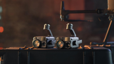
The Zenmuse L3 is defined by several advanced features: 16 returns, a maximum range of 950m, Dual 100M pixels (cameras), IMU Non-Pre-heating, Single port installation, and software support for Gaussian Splatting and Point cloud direct output. It is characterised by high-energy, high pixel, high-precision, and highly integrated components.
What is the maximum measurement range of the Zenmuse L3 LiDAR, and what is the typical practical measuring range?
The L3 has a long-range capability of 950m. This maximum range is specified at 10% reflectivity. The typical practical measuring range is 300-500m, which is also the recommended AGL (Above Ground Level).
What is the typical accuracy provided by the Zenmuse L3?
The typical accuracy is 2-4cm. Specific accuracy measurements include:
- At 120m: Horizontal accuracy of 4cm and Vertical accuracy of 3cm.
- At 300m: Horizontal accuracy of 7.5cm and Vertical accuracy of 5cm.
- The system utilises a high-precision IMU with post-processed Heading Accuracy of 0.02° (1σ) and Pitch/roll Accuracy of 0.01° (1σ), representing a 2.5X improvement.
What type of laser does the Zenmuse L3 use and what is its spot size performance?
The L3 uses a 1535 nm laser with a maximum power of 100W (Class 1). It features a smaller spot size than its predecessor, with a beam diameter of 41mm at a range of 120m, which is only 20% the size of the L2. This smaller spot size enables Higher Detail Capture (e.g., power lines) and Stronger penetration through vegetation.
How many returns does the Zenmuse L3 support, and is the point cloud rate adjustable?
The L3 supports up to 16 returns. The point rate is adjustable with options for 100K/350K/1M/2 MHz. The number of returns achieved depends on the selected point rate:
- 2 MHz: 4 returns.
- 1 MHz: 4 / 8 returns.
- 350 KHz / 100 KHz: 4 / 8 / 16 returns.
For better penetration, it is suggested to use 350 kHz, 16 returns.
What are the specifications of the Zenmuse L3's camera system?
The L3 utilises Dual 100MP Cameras (Dual 100M pixels). These cameras feature Micro 4/3 CMOS sensors. Users can select variable pixel settings: 100MP (12K) or 25MP (6K). It offers a Wide FOV of 107°, which is 27° larger than the LiDAR FOV, ensuring colorisation and orthophotos.
Does the Zenmuse L3 require a warm-up time for the IMU?
No, the Zenmuse L3 supports IMU Non-Pre-heating. It offers Immediate Startup, meaning it is ready for takeoff as soon as the M400 powers on.
Which DJI drone is the Zenmuse L3 compatible with?
The Zenmuse L3 is Only Compatible with M400. This is due to its heavier weight (1.6kg) and higher power consumption (1535nm LiDAR) which the M350's gimbal power supply does not meet.
What protection rating and operating temperature range does the L3 have?
The design features High Protection with an IP54 rating. The operating temperature range is -25℃ to 55℃.
What are the three available scanning modes for the LiDAR sensor?
The L3 offers 3 Scanning Modes:
1. Linear repetitive scanning: Used primarily for Accuracy (H 80°, V 3°).
2. Star-shaped scanning: Used for Accuracy & Penetration (H 80°, V 80°).
3. Non-repetitive scanning: Used primarily for Penetration (H 80°, V 80°).
What software is used for processing Zenmuse L3 data, and is there a cost associated with the processing?
The core software solutions are DJI Pilot 2, DJI Terra, and DJI Modify. L3 data processing in DJI Terra is Completely Free. All data processing functions for the L3 are free of charge, and no license is required. DJI Terra supports features like Point Cloud Gaussian Splatting, PPK, and Cluster reconstruction.
What kind of accuracy check features are available during route planning and post-flight?
During route planning (using DJI Pilot 2), the system provides Point cloud density and distribution estimates based on configured LiDAR settings and flight parameters. Post-flight, on-site quality checks of IMU and GNSS data are available, including calculation of the trajectory before data processing to rapidly assess POS status.
What accessories are included in the Zenmuse L3 package?
The standard package includes the Zenmuse L3 unit (1), a Single Port Gimbal (including a shock-absorbing ball, only compatible with L3) (1), CF-express Type B memory cards (2), a CF-express Type B card reader (1), a screw tool set (1), a storage box (1), a lens cloth (1), and an M400 transport box inner liner (1).
What service or warranty coverage is provided when purchasing the Zenmuse L3?
Purchasing the Zenmuse L3 includes 1 year of DJI Care Enterprise Plus for free in covered regions. This plan offers comprehensive protection, including unlimited free repairs within the coverage limit and free two-way shipping. In regions not covered by DJI Care Enterprise, an Extended Warranty Service provides an extra 1-year warranty for the L3, requiring no binding.


 Safe and Secure Checkout


