How Can Drones Be Used For Tackling Climate Change?
- by Stefan Gandhi
In today’s world, climate change is one of the defining challenges faced by both society and industry. In the UK especially, meeting ambitious targets such as net zero greenhouse gas emissions by 2050 requires fresh, inventive approaches. Among those tools rapidly gaining traction are drones. From hobbyists flying quadcopters across the countryside to professional survey teams mapping remote terrain, drone technology is proving far more than just a recreational gadget. For both consumer and professional users the question is, how exactly can drones help tackle climate change?
In this article we explore that question in depth. We will examine how drones are being used in monitoring, mitigation and adaptation efforts, look at their relevance to different user groups in the UK, outline practical steps you can take now, and frame how the technology might evolve. Let’s lift off.
The Climate Challenge & The Role Of Drone Technology
Climate change manifests in many ways: rising temperatures, shifting weather patterns, increased flooding and coastal erosion, biodiversity loss, altered agricultural systems, and more. Responding effectively means both reducing emissions (mitigation) and managing impacts (adaptation). Drones offer a unique platform, they can gather data quickly, access terrain that is difficult or dangerous, deliver monitoring at high resolution, and support decision making in near real time.
Drones are being deployed in geological, ecological and coastal settings to monitor erosion and changing landform features. They can be equipped with optical, thermal, multispectral or LiDAR sensors to produce 2D and 3D maps of terrain, model erosion and monitor features such as landslides. Additionally, drones support remote sensing in agriculture to optimise resource use, reduce waste and support climate-resilient practices. In short, drones intersect both mitigation and adaptation strategies.
From a business or professional perspective this matters because drones can deliver cost-effective data, reduce risk, speed up decision making and open new service models. For consumers and hobbyists it means more than just flying for fun, it means contributing to environmental awareness and capturing creative content that tells a climate story.
Use Case 1 Monitoring Ecosystems & Biodiversity
One of the most immediate roles for drones in climate work lies in ecosystem and biodiversity monitoring. As habitats shift under climate pressure and extreme events become more frequent, accurate mapping and monitoring are essential.
How It Works
Drones equipped with high resolution cameras, thermal or multispectral sensors can fly over forests, coastal wetlands, peatlands and other critical habitats. They gather imagery and data that can be turned into orthomosaics, 3D point clouds and mesh models. Other research uses drones to monitor seal populations in remote coastal colonies without disturbing them, enabling demographic tracking.
Why This Matters For Climate
Healthy ecosystems play a major role in carbon sequestration, resilience and adaptation. Wetlands, forests and marine habitats such as seagrass beds are key carbon sinks. When they degrade, they release stored carbon and reduce nature’s capacity to buffer climate impacts. Drones help identify loss, track recovery and support evidencebased restoration.
User Angle
-
Professional Users: You might be tasked with delivering habitat surveys, creating detailed models for conservation agencies or supporting carbon-offset projects. A drone with multispectral sensors and LiDAR capability will be vital.
-
Creative Hobbyists / Outdoors Enthusiasts: Use your drone to capture engaging visual content of landscapes, documenting changes over time, or collaborating with conservation projects on citizen science initiatives.
- Family / Gift Buyers: Introduce younger people to environmental monitoring by enabling them to assist in local habitat mapping projects, combining fun flying with purpose.
Use Case 2 Reforestation & Landscape Restoration
Restoring vegetation and forests is widely recognised as a key climate mitigation measure. Drones are increasingly applied in this domain.
How It Works
Flying over degraded land, drones can survey and map areas for seed planting, soil status, and optimal planting positions. Some systems even automate seed dispersion, carrying pods or seed balls and deploying them accurately in inaccessible terrain.
Why This Matters For Climate
Reforestation supports carbon sequestration, enhances biodiversity, stabilises soils, and mitigates flood risk. By enabling quicker, more targeted planting and monitoring, drones increase the scale and efficacy of restoration efforts.
User Angle
-
Professional Users: You may work with restoration organisations, land owners or local authorities to deploy drone-based seed mapping and monitor survival rates.
-
Travel Enthusiasts / Outdoors Enthusiasts: Combine travel or field trips with restoration work, document your journeys flying drones over restoration zones and share compelling visual stories.
- Creative Hobbyists: Capture timelapse aerial footage of reforestation progress, overlaying your visual storytelling with real impact.
Use Case 3 Agriculture, Resource Monitoring & Precision Farming
Agriculture is deeply impacted by climate change and is also a major contributor to emissions. Drones are now embedded in climate smart farming practices.
How It Works
Drones perform remote sensing of crops and soil to monitor health, water stress, nutrient levels and pest outbreaks. They are especially effective when equipped with multispectral or thermal sensors. These tools allow farmers and agronomists to intervene early and optimise input use, such as fertiliser, water or seed.
Why This Matters For Climate
Precision agriculture means less waste of water and fertiliser, lower emissions, improved resilience to extreme weather and better crop yields under changing conditions. Drones provide the data backbone for smarter responses, supporting lowercarbon farming and adaptation to new climate realities.
User Angle
-
Professional Users: If you operate in the agrisector, integrate drones into farm management systems, supply data feeds, and support agronomy decisions.
-
Creative Hobbyists / Outdoors Enthusiasts: Explore rural flying over farmland, capture patterns of crop health or seasonality, and build a portfolio of environmental visual work.
- Family / Gift Buyers: Consider a drone that can monitor home garden or allotment performance, introduce younger members to drone-enabled ecotech.
Use Case 4 Infrastructure, Energy & Inspections For Low-Carbon Systems
As the UK pivots to low-carbon infrastructure, wind turbines, solar arrays, grid networks, drones become valuable inspection and monitoring tools.
How It Works
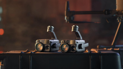
Drones equipped with cameras and sensors can inspect wind turbine blades, solar panels, power lines and even offshore assets. By collecting data on wear, damage or performance degradation drones support maintenance at reduced cost, improved safety and less downtime.
Why This Matters For Climate
Low-carbon infrastructure is vital for the energy transition. Efficient maintenance means better asset performance, longer lifespans, reduced waste and enhanced return on investment. Drones reduce the need for heavy equipment, scaffolding or manned inspection flights.
User Angle
-
Professional Users: Drone inspection is a commercial service opportunity. If you focus on utilities, renewables, infrastructure, add drone capabilities to deliver inspection, data analytics and reporting to customers.
-
High Investment Hobbyists: Consider advanced drones with high-resolution sensors, thermal imaging and long endurance for remote inspection missions, either as a serious application or premium creative project.
- Law Conscious Operators: Ensure you stay compliant with Civil Aviation Authority (CAA) regulations within the UK, especially if using drones near infrastructure or beyond visual line of sight.
Conclusion
Drones are rapidly becoming one of the most accessible and effective tools for confronting climate change. Across diverse applications from ecological monitoring and reforestation to precision farming and infrastructure inspection, drone technology is driving smarter, faster and more sustainable solutions.
To equip yourself with the right tools for climate-focused drone work, visit the Coptrz official online store here and explore our expert-recommended drones for every mission and user type.


